Professional Summary
I’m Head of Science & Innovation at TerraEye, where I lead the team developing geospatial intelligence solutions for the mining industry across the whole project lifecycle — from exploration to reclamation. I have over 15 years of experience in geospatial data science, more than five of them focused specifically on Earth Observation, and my work sits where EO science meets industrial deployment.
I’ve contributed to projects funded by the European Space Agency, the European Commission and Poland’s National Centre for Research and Development, and worked on solutions later adopted by a major global resource group. My focus is integrating multisensor data and applying advanced geospatial analytics and machine learning to mineral exploration and geological interpretation.
Education
PhD in Technical Sciences
2011-10-01
2017-11-30
University of Warmia and Mazury, Olsztyn — Faculty of Geodesy, Spatial Engineering and Construction
MSc studies in Computer Science
2020-10-01
2022-06-30
University of Warmia and Mazury, Olsztyn — Faculty of Mathematics and Computer Science. Specialisation in Systems and Computer Networks Design
Postgraduate Diploma — Data Science in Practice
2018-10-01
2019-03-31
University of Warmia and Mazury, Olsztyn — Faculty of Mathematics and Computer Science
MSc Eng., Geodesy and Satellite Navigation
2006-10-01
2011-07-31
University of Warmia and Mazury, Olsztyn — research internship at Kauno Kolegija, Kaunas, Lithuania (2015)
Interests

2026 — named one of the Geospatial World 50 Rising Stars 2026.

2023, 2024 — TerraEye's team nominated in the CASSINI Challenge twice: in 2023 in the Prototype category (SAR Gate) and in 2024 in the Idea category (AIMS, Asbestos Identification and Mapping Solution).
2020 — member of the winning team at the BalticSatApps hackathon with an application detecting unauthorised (illegal) construction.

2015 — DLR Special Prize, awarded by the German Aerospace Center (DLR) at the European Satellite Navigation Competition (ESNC, formerly Galileo Masters) for the concept of the Mobile Underwater Positioning System (MUPS).

Remote sensing and Earth observation R&D at TerraEye — SAR/InSAR, optical and hyperspectral data for geology and mineral exploration, and turning research methods into operational EO workflows. Critical, limitations-first, practitioner view.
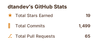
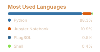
Co-author of papers on hyperspectral mineral detection, mining-area monitoring and GNSS positioning.
18 works · 65 citations ·
h-index 5 · i10-index 2
Source: OpenAlex, 5 Oct 2026.
All publications →